 |
| Facts about Madhya Pradesh (Know Your State) |
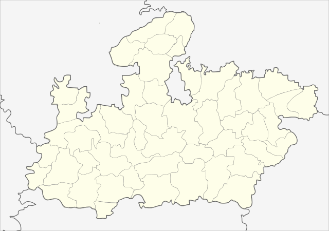
The state of Madhya Pradesh is known as the heart of India due to its geographic location and Bhopal is the capital city of the state while Indore is the largest city and economic hub of the state.
Government of Madhya Pradesh
- Governor: Lalji Tandon
- Chief Minister: Kamal Nath
- Vidhan Sabha: 231 seats (230 elected + 1 nominated)
- Chief Justice of MP High Court: Ravi Shankar Jha (Acting)
- Total Divisions: 10
- Total Districts: 52
- Total Tehsils: 362
- Total Muncipal Corporations: 16
- Total Nagar Palika: 98
Geography of Madhya Pradesh
- Area: 308252 sq km
- Area Rank: 2
- Latitude: 21°06'N - 26°30'N
- Longitude: 74°09'E - 81°48'E
- Regional Extention: 870 km East to West and 605 km North to South
- Neighbouring States: Gujarat, Rajasthan, Uttar Pradesh, Chhattisgarh and Maharashtra
- Agroclimatic Zones: 10 (Kaimur Plateau and Satpura Hills, Satpura Plateau, Vindhyan Plateau, Narmada valley, Wainganga valley, Bundelkhand, Gird (Gwalior), Malwa Plateau, Nimar Plateau, Jhabua Hills and Leeshiv)
- Prime Meridian: Passes through Singrouli District
- Tropic of Cancer: Passes through 14 Districts - Bhopal, Vidisha, Raisen, Rajgarh, Ujjain, Ratlam, Sagar, Damoh, Katni, Shahdol, Umaria, Sihore, Agar Malwa, and Jabalpur
- Longest State Boundary: Uttar Pradesh
- Smallest State Boundary: Gujarat
- Largest District Area Wise: Chhindwara (11,815 sq km)
- Smallest District Area Wise: Niwari (1318 sq km)
- Bordering District of Madhya Pradesh with Rajasthan: 10
- Bordering District of Madhya Pradesh with Uttar Pradesh: 13
Population of Madhya Pradesh (2011)Total Population: 72,626,809
State Rank: 5
- Urban Popilation: 20,059,666
- Rural Popilation: 52,537,899
- Population Density: 240
- Sex Ratio: 931
- Literacy: 70.6
- Male Literacy: 78.7
- Female Literacy: 59.2
- Highest Literacy District: Jabalpur (81.1)
- Lowest Literacy District: Alirajpur (36.1)
- Highest Male Literacy District: Indore (87.3)
- Highest Female Literacy District: Bhopal (78.3)
- Highest Decadal Population Growth: Indore
- Lowest Decadal Population Growth: Anuppur
- Highest Rural Population District: Rewa
- Highest Urban Population District: Indore
- Highest Sex Ratio: Balghat (1021)
- Highest Scheduled Tribe Population District: Dhar
- Highest Scheduled Caste Population District: Ujjain
- Lowest Sex Ratio: Bhind (837)
- HDI: 0.594
- GDP: 8.09 lakh crore (2018-19)
- Religion: Hinduism (90.89%), Muslim (6.57%), Jain (0.78%), Buddhists (0.30%), Christians (0.29%), Sikhs (0.2%) and Others (0.83%)
- Languages: Hindi (88.57%), Marathi (1.70%), Urdu (1.26%) and Others (8.47%)
State Symbols of Madhya Pradesh
- State Animal: Barasingha
- State Bird: Indian Paradise Flycatcher (Dudharaj)
- State Fish: Mahseer
- State Fruit: Mango
- State Flower: White Lily
- State Tree: Banyan Tree
- State Song: Madhya Pradesh Gaan
- State Dance: Rai
- State Theatre: Maach
- State Sport: Mallakhambha
- State Language: Hindi
